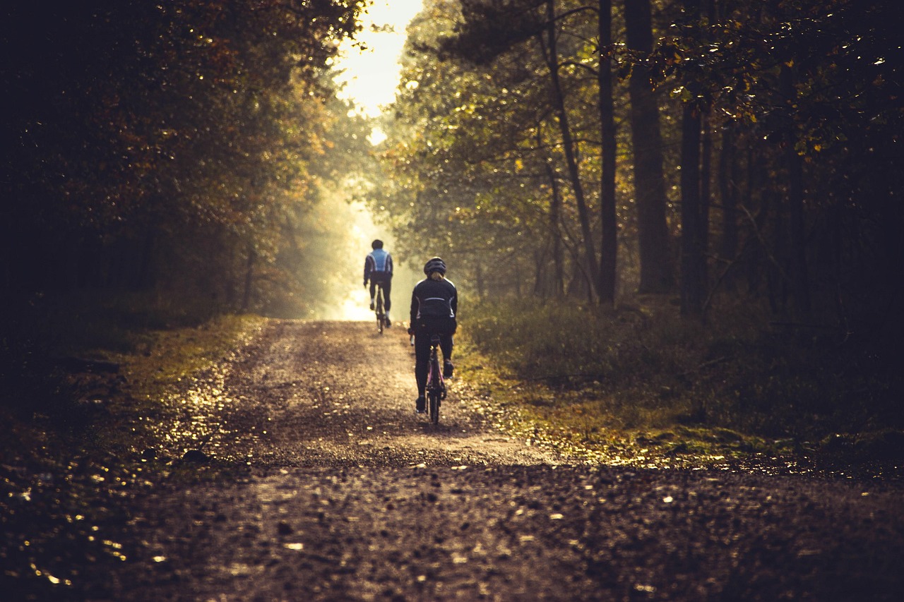
Autumn transforms rail trails into some of the most inviting biking paths in North America. Cooler air, colorful forests, and quiet multi-use trails create the perfect mix for cycling. If you want the best places to enjoy fall foliage on two wheels, these eight rail trails stand out for their scenery, history, and accessibility.
- Katy Trail State Park in Missouri stretches across nearly the entire state, following the Missouri River for long sections. You ride past limestone bluffs, farmland, and historic river towns, making it one of the most scenic long-distance trails in the country.
- Great Allegheny Passage, running from Pittsburgh to Cumberland, Maryland, takes you through the Appalachian Mountains with tunnels, viaducts, and sweeping views of wooded hills glowing with autumn color.
- Empire State Trail in New York covers hundreds of miles linking the Hudson Valley, Adirondacks, and upstate towns. Its mix of river views, mountain backdrops, and small communities makes it a varied and rewarding fall ride.
- Little Miami Scenic Trail in Ohio carries you through farmland, forests, and small towns, with stretches that light up in shades of yellow and red each October.
- Allegheny River Trail in Pennsylvania follows a quiet stretch of river framed by hardwood forests and passes through historic railroad tunnels and towns.
- Galloping Goose Trail in Colorado winds through the San Juan Mountains, where golden aspen groves contrast against snow-dusted peaks.
- Boise River Greenbelt in Idaho offers a more urban but equally colorful ride, with a paved path lined by cottonwoods and wildlife along the river.
- Lake Wobegon Trail in Minnesota runs through farmland, lakes, and woodlands, with wide-open views and bursts of red and gold that define the Midwest in fall.
These trails give you a direct way to enjoy the season’s best landscapes while staying active on safe, car-free routes.
What Makes a Rail Trail Ideal for Autumn Cycling?
The best rail trails in autumn balance scenic views, comfortable riding conditions, and easy access to nearby services. You benefit most when the trail offers reliable surfaces, clear trailheads, and welcoming towns that make the ride both practical and enjoyable.
Scenic Fall Foliage and Seasonal Beauty
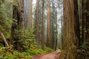
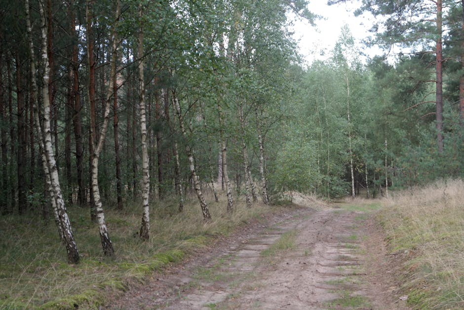
You want a trail that highlights the season’s colors. Rail trails often pass through forests, river valleys, and farmland where maples, oaks, and birches create strong displays of red, orange, and yellow.
Because most rail trails follow gentle grades, you can focus on the scenery without struggling with steep climbs. Multi-use trails that run near rivers or lakes also reflect autumn colors, giving you double the views.
Timing matters. Northern trails typically peak in late September, while mid-Atlantic and Midwest routes peak in October. Southern trails may hold color into November. Planning your ride around these windows helps you capture the best conditions.
Trail Surface Types and Bike Compatibility
The surface of a rail trail determines how smooth your ride will feel and what kind of bike works best. Many trails are paved, making them ideal for road bikes and hybrid bikes. Others use crushed stone or packed dirt, which are better suited for mountain bikes or wider tires.
A paved surface usually means faster speeds and easier rolling, while crushed limestone offers a quieter, softer ride. Dirt sections may become muddy after rain, so you should check recent conditions before setting out.
When trails mix surfaces, you may want a versatile bike with 32–40mm tires. This range works well on both pavement and gravel. If you plan to rent a bike near the trailhead, confirm what type of bike rentals are available so you can match your choice to the trail surface.
Accessibility and Trailhead Amenities

Trailheads make your ride easier by providing parking, restrooms, and maps. You should look for clear signage at the start and along the route so you can track your progress without relying only on GPS.
Some larger trailheads also include water fountains, picnic areas, and bike repair stations. These features are especially useful on longer rail trails where services may be spread out.
Accessibility also depends on how close the trailhead is to major roads or public transportation. A trail that connects easily to nearby towns or highways saves you time and simplifies planning.
Trail Towns and Local Experiences
Rail trails often pass through small towns that welcome cyclists. These trail towns may offer bike shops, cafés, breweries, and bed-and-breakfasts. You can stop for a meal, repair a flat tire, or even stay overnight.
Local history also plays a role. Many rails-to-trails routes follow former railroad corridors that once supported industry or trade. Interpretive signs, restored depots, and museums give you a sense of place while you ride.
Supporting local businesses along the way adds to your trip. Whether you buy a snack, rent a bike, or stay in a local inn, these towns benefit from trail tourism and often reinvest in maintaining the rail trail system.
Katy Trail State Park, Missouri: Autumn Along the Missouri River
You can follow the Katy Trail across nearly 240 miles of Missouri, where history, scenery, and a smooth riding surface come together. The path runs along the Missouri River for much of its length, offering steady views of bluffs, farmland, and small towns that make autumn rides especially rewarding.
Historic Missouri-Kansas-Texas Railroad Corridor
The Katy Trail was built on the old Missouri-Kansas-Texas Railroad (MKT) line, which locals nicknamed the “Katy.” When the railroad stopped operating in Missouri during the 1980s, the state converted the right-of-way into a public trail.
You ride along the same corridor that once carried freight and passengers across the state. Many towns along the route grew up around the railroad and still welcome visitors today.
The trail also overlaps with the Lewis and Clark National Historic Trail, connecting your ride to an even deeper layer of American history. Markers and interpretive signs along the way explain events and local stories, giving you context as you pedal through the landscape.
River Views and Limestone Bluffs
Much of the Katy Trail follows the Missouri River, with long stretches running directly beside the water. In autumn, the bluffs that rise above the river glow with red, orange, and yellow leaves.
The scenery changes often. One moment you pass farmland and open fields, the next you ride under tall trees pressed against the limestone walls. These bluffs create natural shade and a sense of enclosure while still leaving room for wide river views.
Several towns, such as Rocheport and Hermann, sit in especially scenic sections. These make good stopping points if you want to combine your ride with local food, historic sites, or wineries that are common in this part of Missouri.
Trail Surface and Best Sections for Fall
The Katy Trail uses a crushed limestone surface that stays mostly flat and firm, making it suitable for hybrid bikes, road bikes with wider tires, and even casual riders. The gentle grade means you can cover long distances without steep climbs.
For fall rides, the stretch between St. Charles and Rocheport is especially popular. This section combines river views, limestone bluffs, and easy access to small towns. It also tends to show the brightest foliage in late October.
If you prefer quieter paths, the western portion near Sedalia and Clinton offers fewer crowds but still delivers open farmland views and peaceful rides in cooler weather. Each section provides a different way to experience Missouri’s longest rail-trail.
Great Allegheny Passage: Appalachian Colors from Pittsburgh to Cumberland
The Great Allegheny Passage spans 150 miles through Pennsylvania and Maryland, carrying you from the city of Pittsburgh to the historic town of Cumberland. You ride through the Appalachian Mountains, pass scenic valleys, and encounter small communities that make the trail both practical and memorable.
Laurel Highlands and Allegheny River Scenery
You begin near Pittsburgh, where the trail follows rivers and wooded corridors before reaching the Laurel Highlands. In autumn, this area offers a wide range of colors as maples, oaks, and birches change. The hillsides create striking views, especially when the Allegheny River reflects the fall foliage.
The route includes long stretches of forest, waterfalls, and viaduct crossings. One highlight is the Eastern Continental Divide, the highest point on the passage at 2,375 feet. From there, you experience a steady downhill ride into Cumberland.
Tunnels such as the Big Savage Tunnel add variety to the scenery. On warm days, the tunnel’s cooler air creates a noticeable change in temperature. When you exit, the mountain views stretch for miles, making it one of the most photographed spots along the trail.
Trail Towns and Historical Landmarks
Every 10 to 15 miles, you reach a trail town that provides food, lodging, and bike services. Places like Ohiopyle, Connellsville, and Meyersdale let you rest and explore. Ohiopyle is especially popular for its waterfalls and access to whitewater rafting.
Many towns preserve their railroad heritage. You see old depots, bridges, and even interpretive signs that explain the region’s industrial past. The Salisbury Viaduct, once part of the Western Maryland Railway, now gives you sweeping views of farmland and valleys.
Near Frostburg, you pass the site of the Cumberland Bone Cave. Though the cave itself is closed, the sign explains how fossils of extinct animals were discovered there in the early 1900s. These details connect your ride to the broader history of the Appalachian region.
Cycling Experience and Trail Maintenance
The trail surface is mostly crushed limestone, which creates a smooth ride in dry conditions. About 20 miles near Pittsburgh and Cumberland are paved, making those sections easier during wet weather. Wider tires give you more stability, especially after rain.
The grade is gentle because the route follows old rail beds. The steepest sections rarely exceed 1.75%, so you can maintain a steady pace without long climbs. This makes it approachable for both long-distance riders and casual cyclists.
You benefit from consistent upkeep by volunteers and local organizations. They clear fallen trees, repair erosion, and keep tunnels safe for travel. Maintenance crews respond quickly after storms, which helps you plan multi-day rides with confidence that the trail will remain passable.
Empire State Trail, New York: Hudson Valley and Adirondack Splendor
The Empire State Trail stretches 750 miles across New York, linking New York City, Albany, Buffalo, and the Canadian border. You can ride through river valleys, farmland, and mountain foothills, with each section offering distinct scenery and terrain.
Hudson River Valley and Upstate Autumn Views
When you bike through the Hudson River Valley, you follow a corridor that blends historic towns with natural beauty. The trail runs north from Manhattan to Albany, passing through Poughkeepsie, New Paltz, and Kingston.
In autumn, you’ll see the hillsides covered in red, orange, and yellow leaves. Vineyards, apple orchards, and farm stands line parts of the route, giving you plenty of places to pause and enjoy local food.
The Walkway Over the Hudson, a 1.28‑mile pedestrian bridge in Poughkeepsie, is a highlight. From this elevated crossing, you get wide views of the Hudson River and surrounding ridges. The path here is paved and accessible, making it easy to ride even if you prefer a shorter trip.
Adirondack and Lake Champlain Sections
North of Albany, the trail shifts into a different landscape as it follows the Champlain Canalway and continues toward Lake Champlain. This section includes more road riding and rolling terrain, especially as you approach the Adirondack foothills.
You’ll pass small towns, open farmland, and forested stretches with fewer crowds. In fall, the Adirondack Mountains create a striking backdrop with their dense hardwood forests. Expect cooler temperatures and sharper climbs compared to the valley routes.
Lake Champlain marks one of the most scenic endpoints. The shoreline views and access to historic sites, such as forts from the Revolutionary War era, give this part of the trail a mix of nature and history. It’s a quieter ride, but one that rewards you with wide open water and mountain vistas.
Connecting New York City to Albany
The section between New York City and Albany is known as the Hudson Valley Greenway Trail. It begins at The Battery in Lower Manhattan and travels north through parks, greenways, and on‑road connectors.
As you ride out of the city, you move from urban streets into suburban areas and eventually into rural countryside. Each transition shows a different side of New York State.
Albany serves as a central hub where the trail splits west toward Buffalo along the Erie Canal and north toward Lake Champlain. This makes the New York City to Albany stretch a key link if you want to explore longer distances across the state.
Little Miami Scenic Trail, Ohio: Riding Through Colorful Farmlands
This 78-mile rail trail in southwest Ohio follows the Little Miami River and passes through farmland, forests, and small towns. You ride on a paved surface that supports different activities while also gaining access to wider trail networks that stretch across the state.
Paved Multi-Use Pathways
The Little Miami Scenic Trail gives you a smooth, paved route that makes biking, walking, and running comfortable. The surface is wide enough to handle steady traffic, so you can share the trail with others without feeling crowded.
Much of the path is shaded by trees, which helps during warmer days. In autumn, the canopy changes into red, orange, and yellow, creating a colorful ride. The river runs alongside long stretches, giving you steady views of water and farmland.
You can start in Newtown near Cincinnati and ride north to Springfield, covering nearly 78 miles. Along the way, you pass through towns like Loveland, Morrow, and Xenia. Each one offers places to rest, eat, or explore.
Because it is a multi-use trail, you may also see horseback riders in Greene County. This mix of uses makes it one of the more versatile trails in Ohio.
Connections to Buckeye Trail and Beyond
The Little Miami Scenic Trail is not an isolated path. It links into the Buckeye Trail, a 1,400-mile loop that circles the entire state of Ohio. This means you can use it as part of a much longer ride or hike if you want to extend your trip.
At Xenia Station, four major trails meet. This hub allows you to branch off toward Dayton, Columbus, or other parts of the Miami Valley Trails network. The southern section also connects to the Ohio to Erie Trail, which runs across the state from Cincinnati to Cleveland.
These connections make the trail useful for both short outings and multi-day rides. You can plan a casual afternoon ride or build it into a cross-state cycling trip. The flexibility gives you more options than many other rail trails.
Other Unmissable Autumn Rail Trails Across North America
You can find rail trails that highlight striking fall scenery, from granite peaks and pine forests to coastal paths lined with colorful maples. Each route blends natural beauty with history, offering both easy day rides and longer cycling adventures.
George S. Mickelson Trail, South Dakota: Black Hills Beauty
The George S. Mickelson Trail stretches 109 miles through South Dakota’s Black Hills. You ride past pine forests, open meadows, and rugged rock formations, with steady grades that make the trail approachable for most riders.
Along the way, you cross nearly 100 converted railroad bridges and pass through several tunnels carved into the hillsides. These features give the trail a distinctive character you won’t find on many other routes.
Trail towns like Deadwood and Hill City provide food, lodging, and history stops. You can also connect with nearby landmarks such as Mount Rushmore and Wind Cave National Park, making this trail a strong choice if you want both scenery and cultural attractions in one trip.
Paul Bunyan State Trail, Minnesota: Lakes and Forests
Minnesota’s Paul Bunyan State Trail runs 119 miles between Bemidji and Brainerd, making it the state’s longest paved bike trail. The path winds past more than 20 lakes, 10 rivers, and dozens of wooded stretches that show off autumn colors.
Because the trail is paved and relatively flat, you can ride long distances without difficulty. Families especially appreciate the easy terrain and frequent access points.
Small towns like Nisswa and Pequot Lakes sit directly on the route, giving you places to stop for rest or meals. A canopy of aspens, maples, and oaks makes the fall ride especially rewarding, with plenty of shaded stretches that highlight the state’s “land of 10,000 lakes” identity.
Cape Cod Rail Trail, Massachusetts: New England Charm
The Cape Cod Rail Trail covers 25 miles across Massachusetts, linking towns such as Dennis, Orleans, and Wellfleet. The route follows a former rail line and provides a flat, paved surface that makes it accessible for riders of all levels.
In autumn, you see classic New England charm with colorful foliage, cranberry bogs, and coastal views. The trail also passes through Nickerson State Park, where kettle ponds and wooded areas create excellent picnic stops.
Because the trail connects multiple towns, you can plan short loops or longer out-and-back rides. Bike rental shops, cafés, and trail maps are easy to find along the way, which makes planning simple even if it’s your first visit to Cape Cod.
Olympic Discovery Trail, Washington: Pacific Northwest Vistas
The Olympic Discovery Trail currently stretches about 90 miles across Washington’s Olympic Peninsula, with plans for nearly 140 miles when complete. The trail mixes paved and gravel sections, leading you through forests, valleys, and along the Strait of Juan de Fuca.
You ride past rivers, coastal bluffs, and even glimpses of Olympic National Park. In autumn, the moss-covered trees and misty mornings create a distinct Pacific Northwest atmosphere.
Sections near Port Angeles and Sequim are especially popular because they are fully developed and easy to access. Trail experts recommend checking updated maps before you go, since some gaps remain in the route. Even with breaks, you can experience a wide range of scenery in a single ride.